
This IDEA Lab project focused on the application of cloud computing services to facilitate heritage documentation and digital preservation of heritage resources. It examined St. Albert River Lots in Alberta, western Canada, and will contribute to a larger research idea that will explore the application of the Climate Vulnerability Index (CVI) in heritage conservation practice in Canada.
This research project was presented at the CIPA 2023 Symposium. The Proceedings of the CIPA 2023 Symposium have been published on the International Archives of the Photogrammetry, Remote Sensing and Spatial Information Sciences (ISPRS Archives):
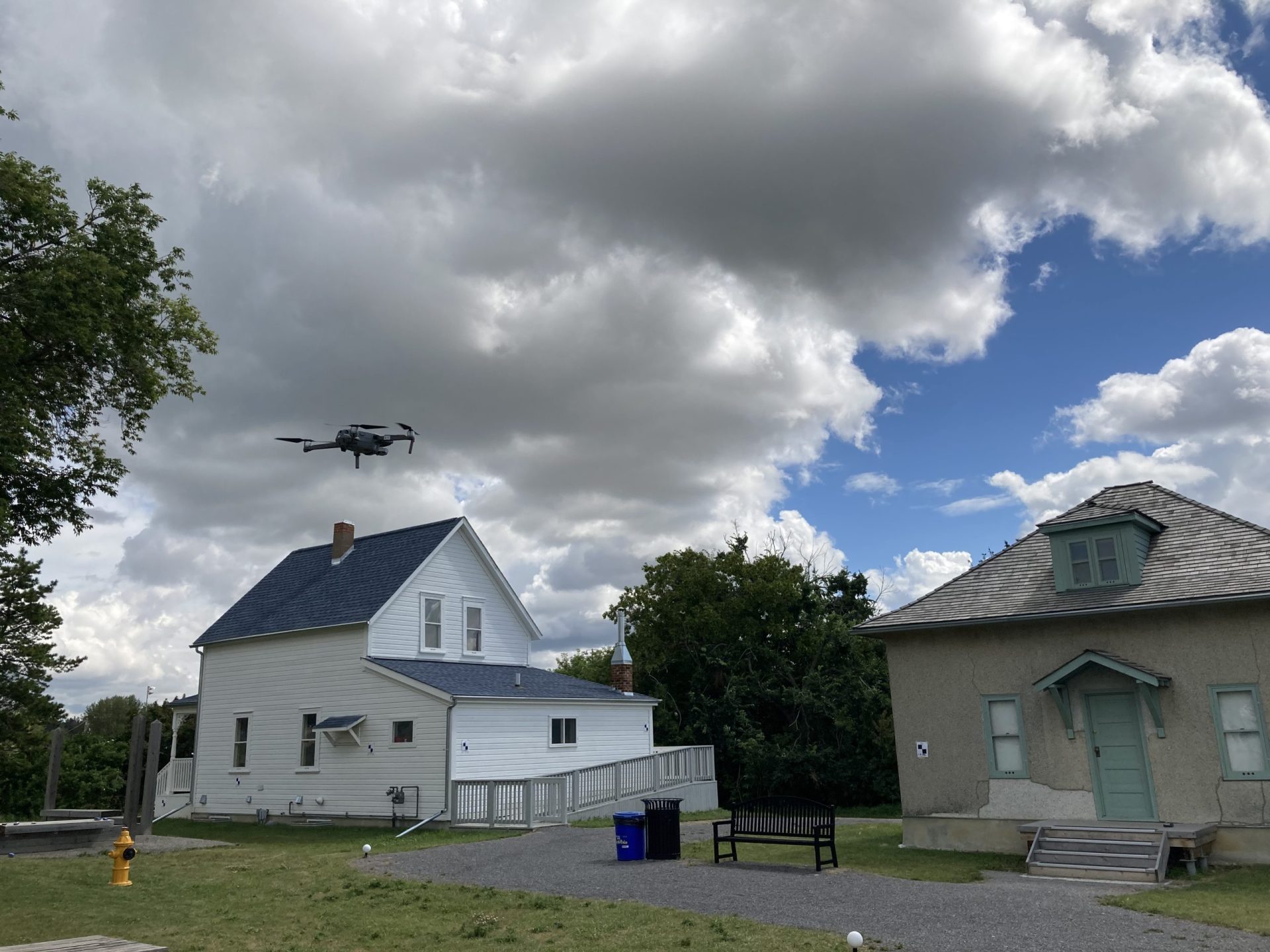
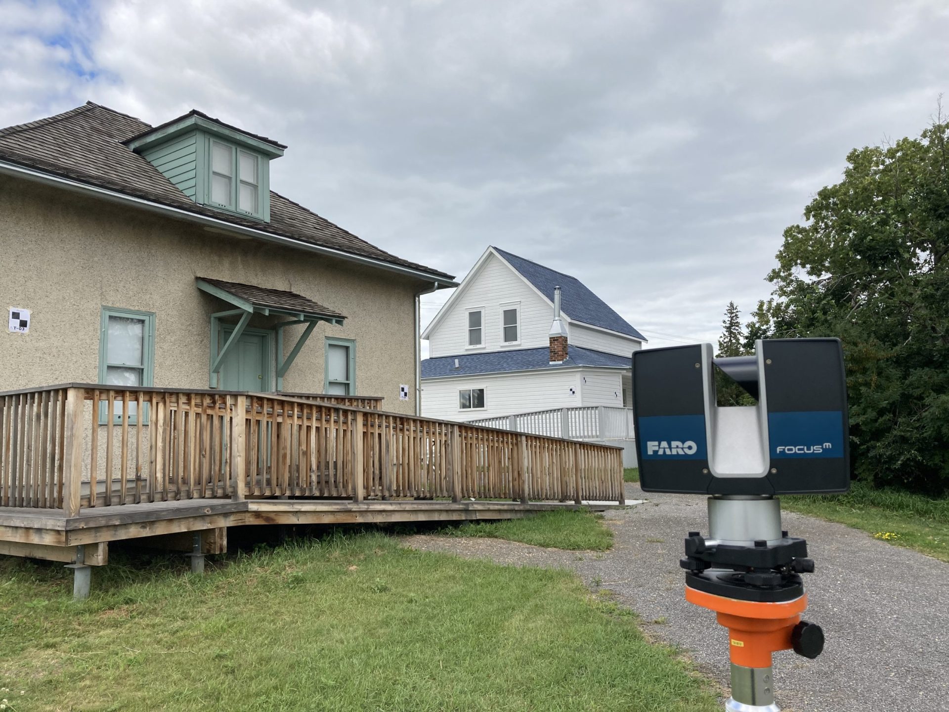
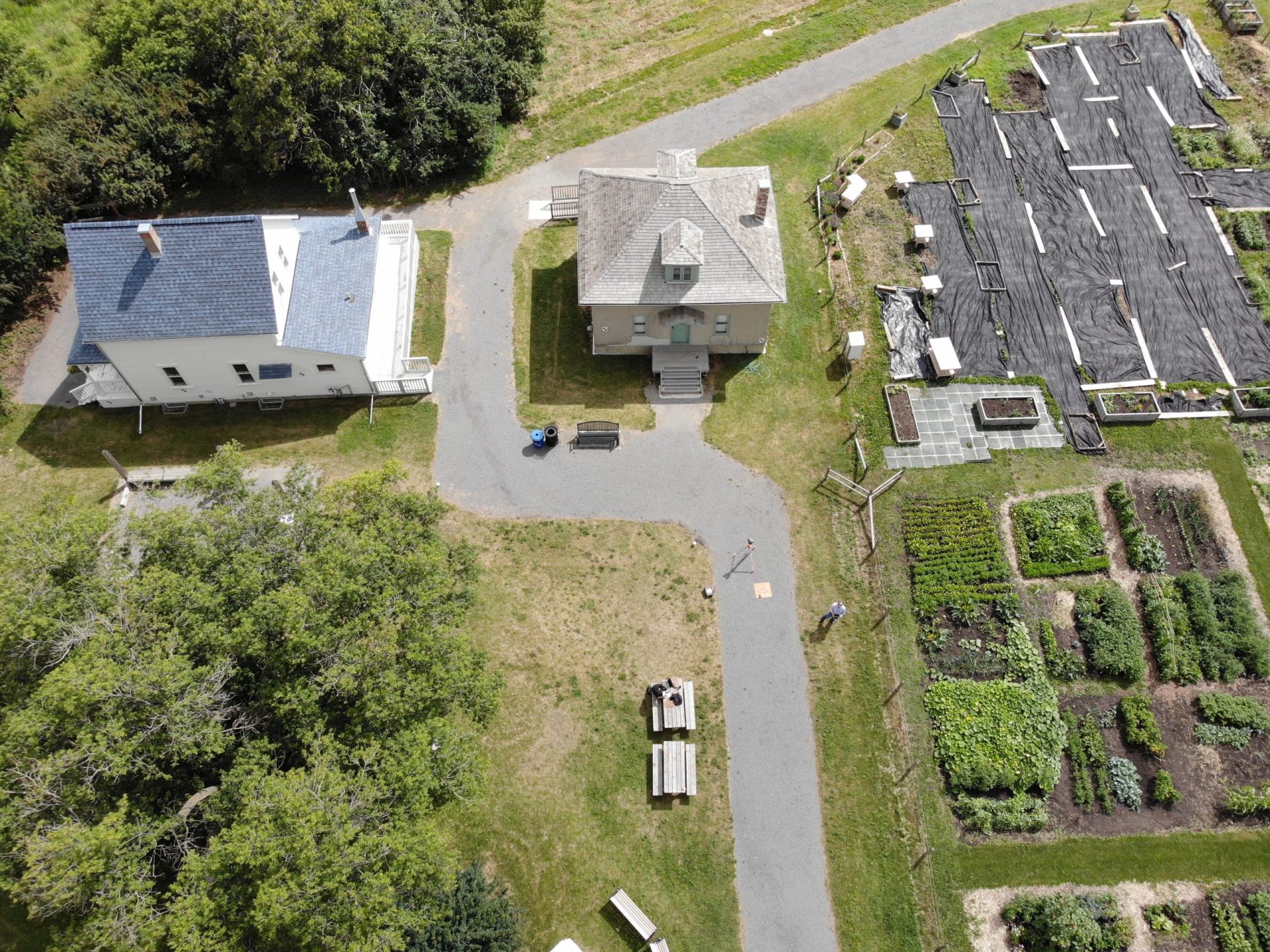
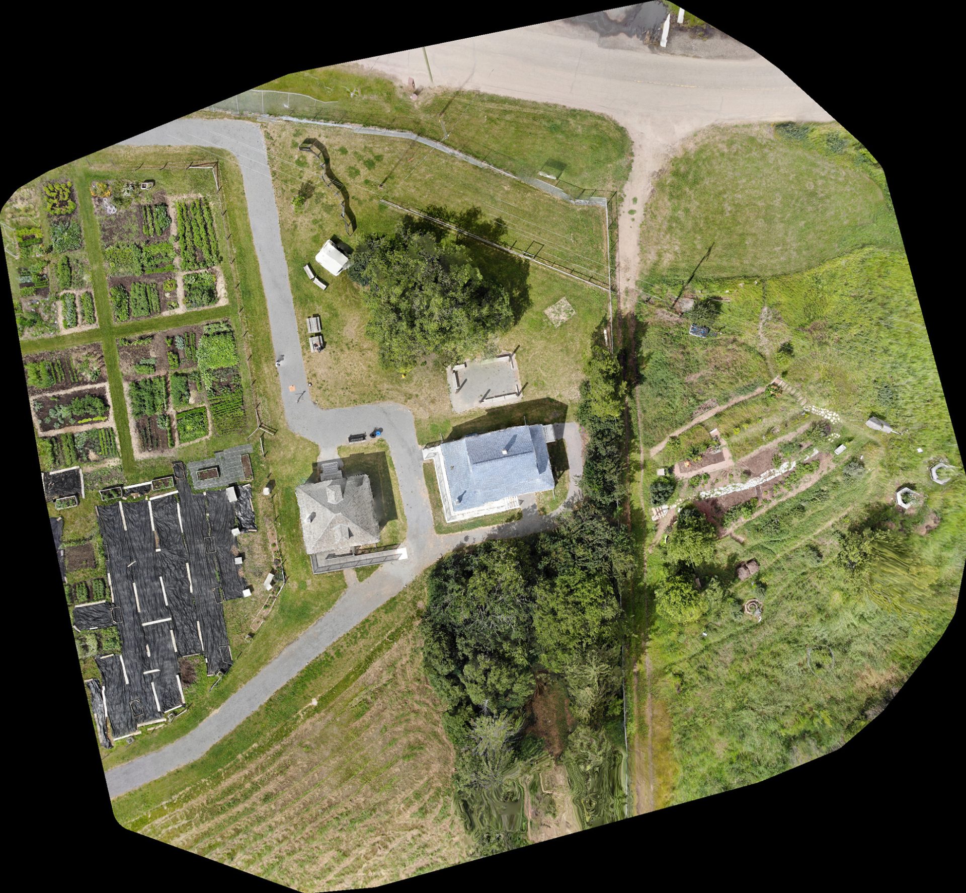
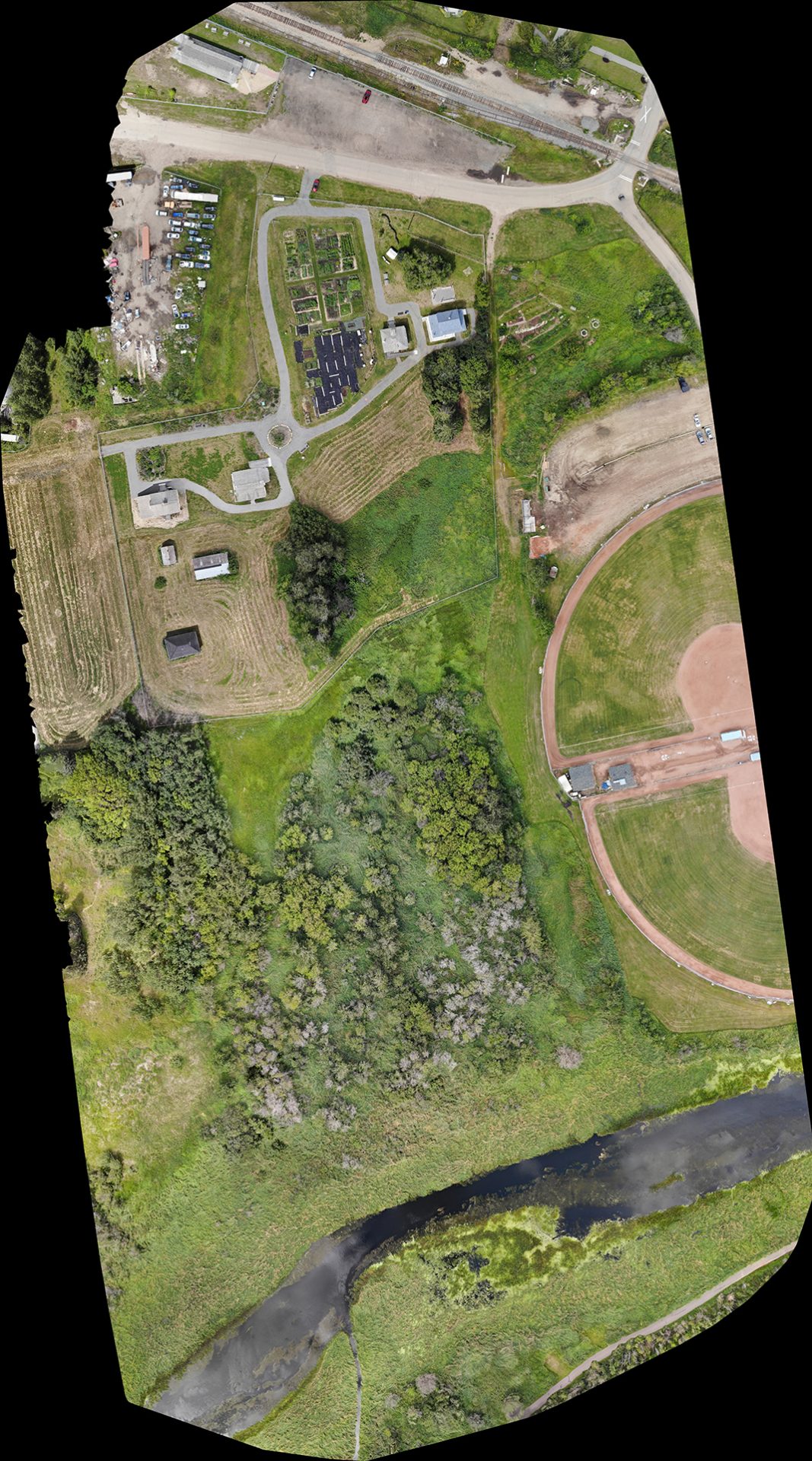
A remotely piloted aircraft system (RPAS) was used to capture georeferenced images of the site. This data was used to create a Digital Surface Model (DSM), a Digital Elevation Model (DTM), and a virtual environment/context to present the 3D building models. A terrestrial laser scanning platform was utilized to collect 3D measurement points from the extant structures and later processed to create 3D models of the structures. A complete photographic record of current conditions of the buildings and the landscape was collected using a DSLR camera. Combined, these data sets then were used to create a virtual model of the structures within their environment.
The project benefited from cloud computing services and explored applicable opportunities for digital preservation, site monitoring, and knowledge dissemination in the heritage field. Selected services and tools that were utilized to achieve project objectives were AWS EC2, AWS S3 bucket, file transmission technologies (i.e., Cyberduck, WinSCP, and SCP/SSH), and 3D processing application (i.e, WebODM, 3DF Zephyr, and Meshroom).